

Reality Capture • Site Data • Survey Support
Field Capture to CAD Ready Data
We help contractors, developers, civil engineers, and licensed surveyors turn site conditions into accurate, organized data through drone mapping, LiDAR, ground control, and progress documentation.
From Raw Data to Project Deliverables
HardHat Aerial Services is built around one goal: turning field conditions into usable project data. We combine aerial mapping, LiDAR, ground control, and processing workflows to create organized deliverables for construction, civil, and survey teams.
We also support drone operators and project partners who need help planning flights, processing datasets, troubleshooting coordinate system issues, or turning raw drone data into CAD/GIS-ready deliverables.
Whether we capture the data ourselves or help refine data that has already been collected, our role is to make the final output accurate, organized, and useful for real project workflows.
What We Deliver
-
![]()
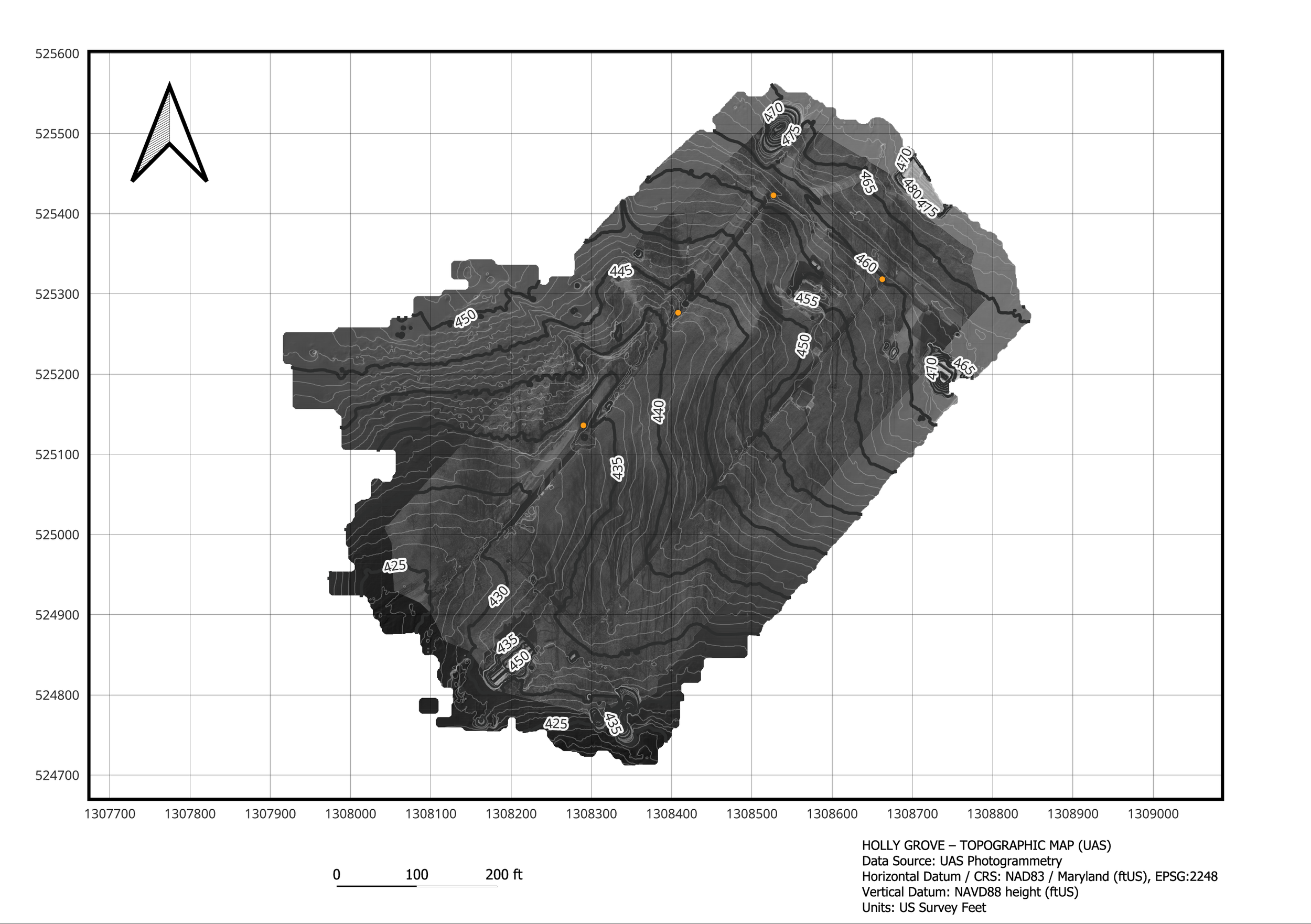
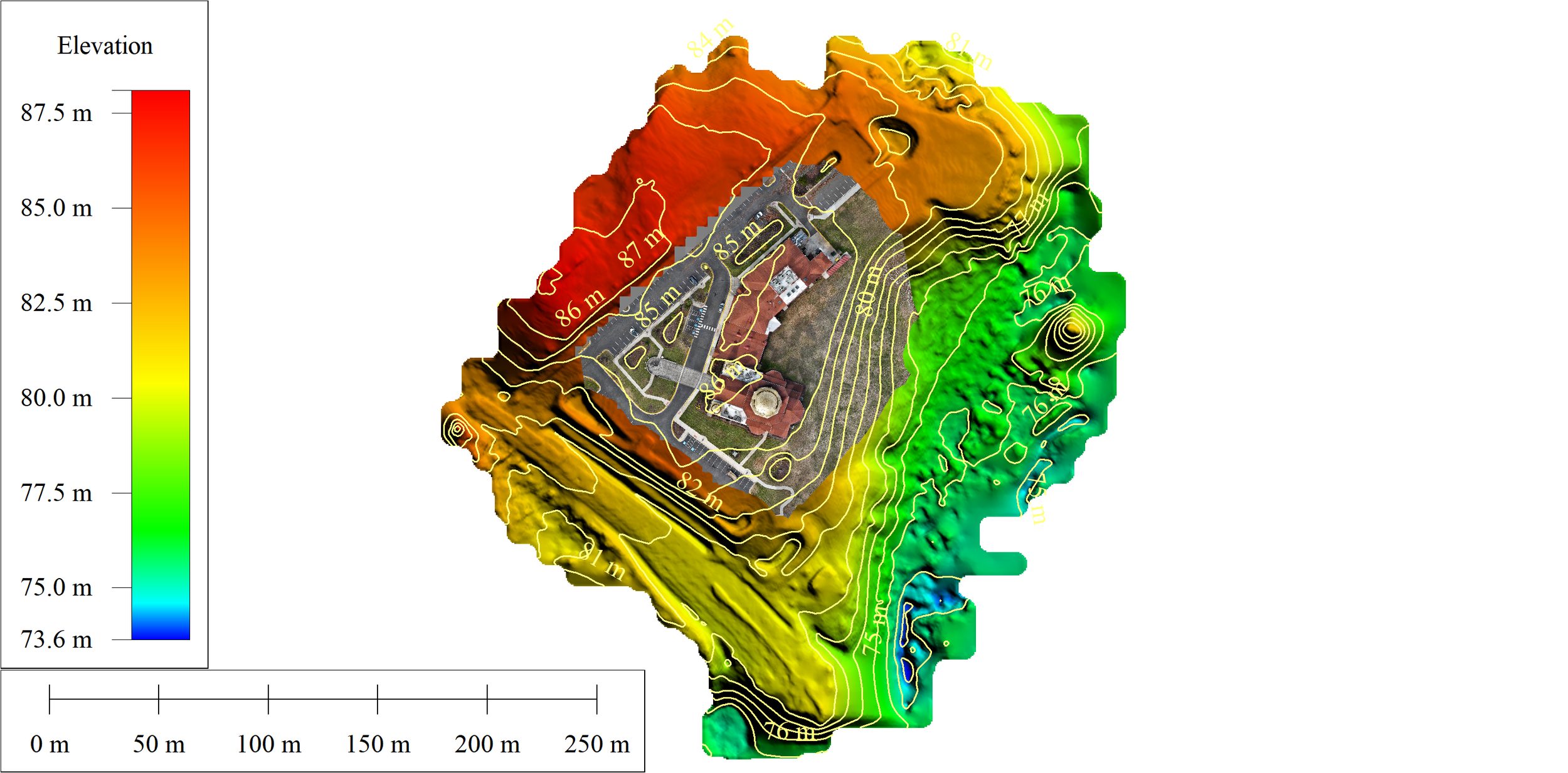
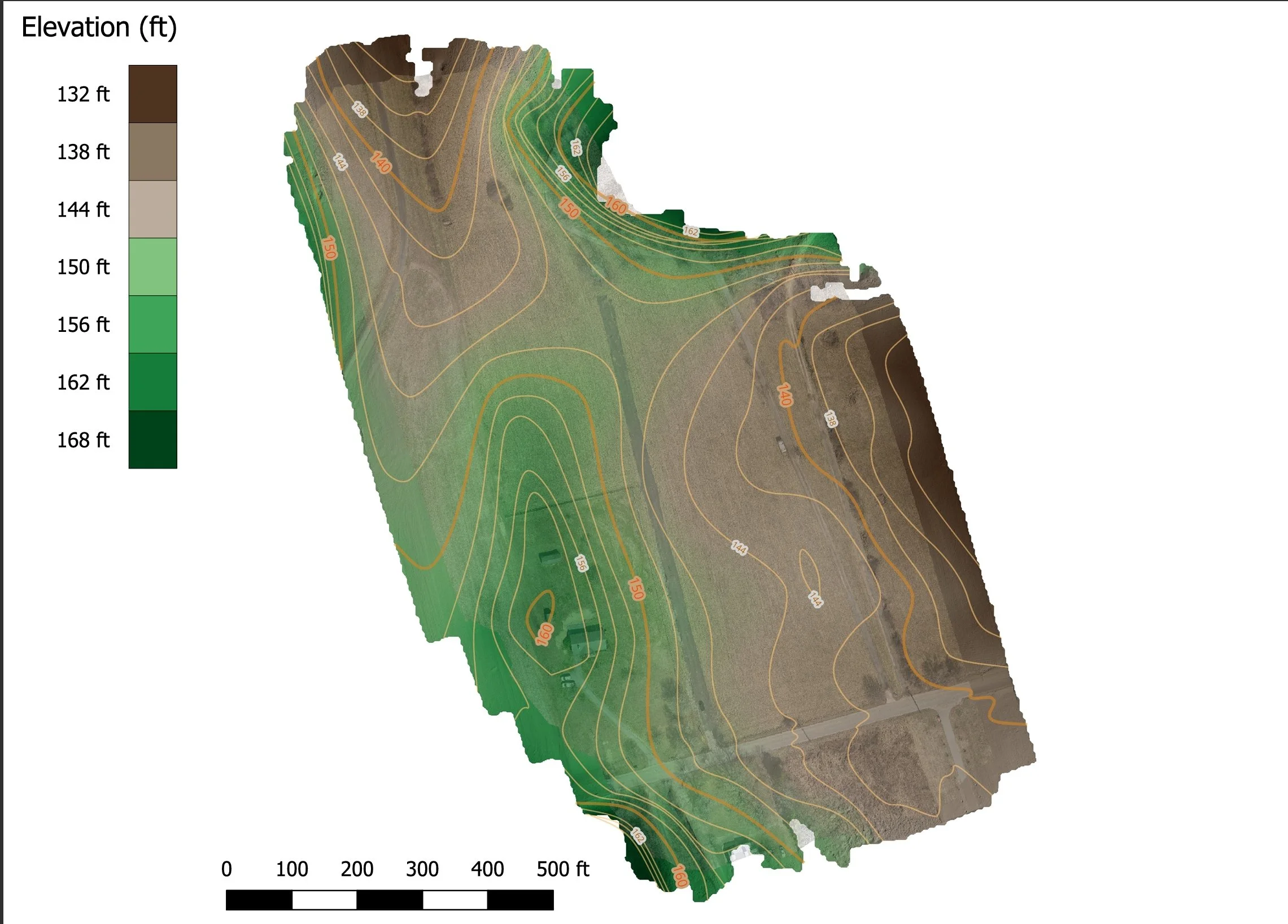
Mapping & Surface Data
Orthomosaics, point clouds, DSM/DTM surfaces, and 3D site models for existing conditions and project documentation. -
![]()
Survey-Support Deliverables
Contours, checkpoint summaries, control-aware mapping, and CAD/GIS-ready files including LandXML, DXF, and other organized outputs. -
![]()
Construction Documentation
Progress mapping, recurring site updates, photo documentation, and organized visual records to support project tracking and communication. -
![]()
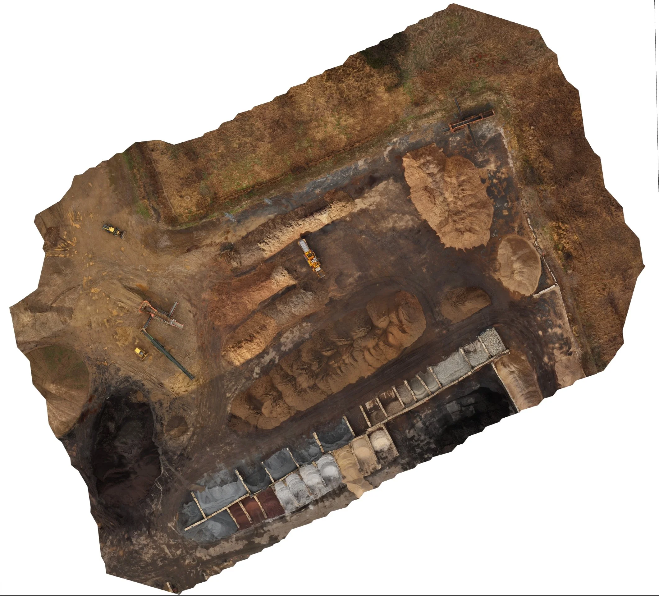
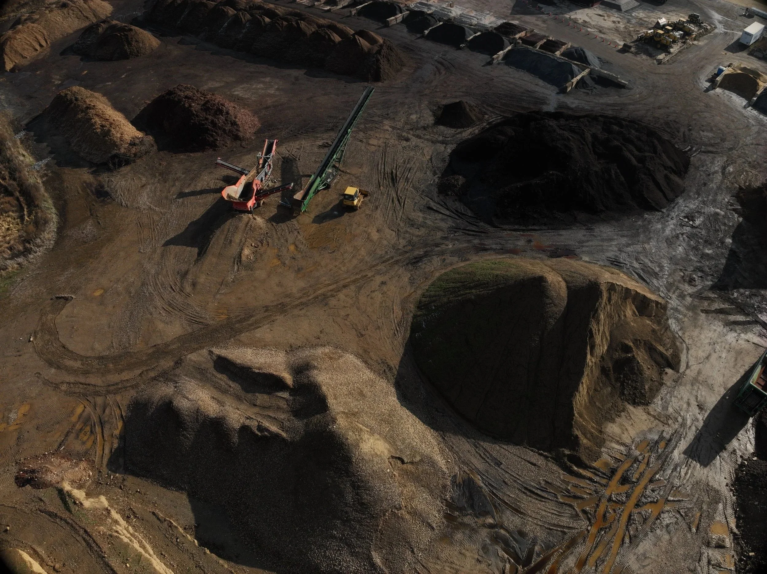
Earthwork & Quantity Reporting
Stockpile volumes, cut/fill comparisons, surface-to-surface analysis, and quantity reports for contractors and site teams.
Where Site Data Creates Value
Existing Conditions & Planning
Document site conditions before construction, grading, or design decisions are made. Useful for planning, coordination, and project records.
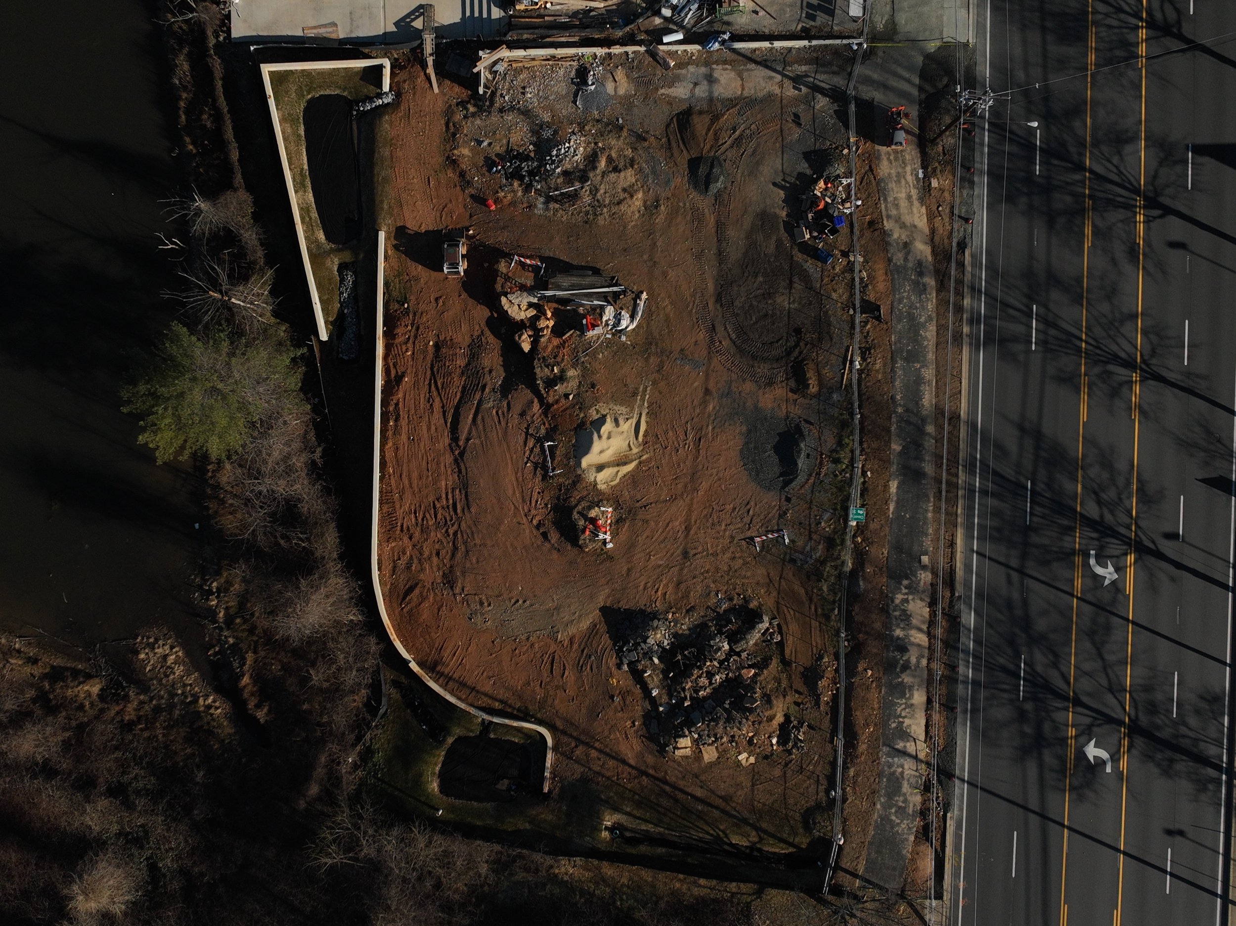
Progress Tracking & Documentation
Capture recurring site updates to show what changed, support owner communication, and maintain organized project records throughout construction.
Earthwork & Quantity Checks
Use surface data to support stockpile volumes, cut/fill comparisons, and quantity tracking for grading, excavation, and material management.
Aerial Inspections
Safer, faster visuals for hard-to-reach areas.
Roof inspections for leaks, storm damage, and aging materials
HVAC & AC unit inspections on commercial and residential roofs
Building envelope & facade checks for cracks, settlement, and wear
Electrical line & equipment visuals (where permitted by regulations)
Close-up detail shots and video for maintenance reports and insurance documentation
Inspection of a high‑voltage power transmission structure
View of rooftop HVAC units for maintenance planning
Contact Us

FAA Part 107 Certified Remote Pilot
OSHA-10 Certified
Fully Insured